Great Gnats Head in photos
During the rain, wind and (rare) winter-sun days of early 2024, the South West Peatland Partnership worked at Great Gnat’s Head (GGH) to help slow the flow of water rushing off the area, reduce erosion, and help to improve the hydrological functioning of the shallow peat. Now, 3 months on from the works pausing for the bird nesting season, let’s look back at the why, how and what next for this complex and fascinating area of Dartmoor.
Great Gnats Head is found on SW Dartmoor on National Trust land within the English Heritage “Upper Plym” estate. SWPP worked to restore the hydrology and ecological function of the vital habitats and conserve the historic environment of the peatland at Great Gnats Head.
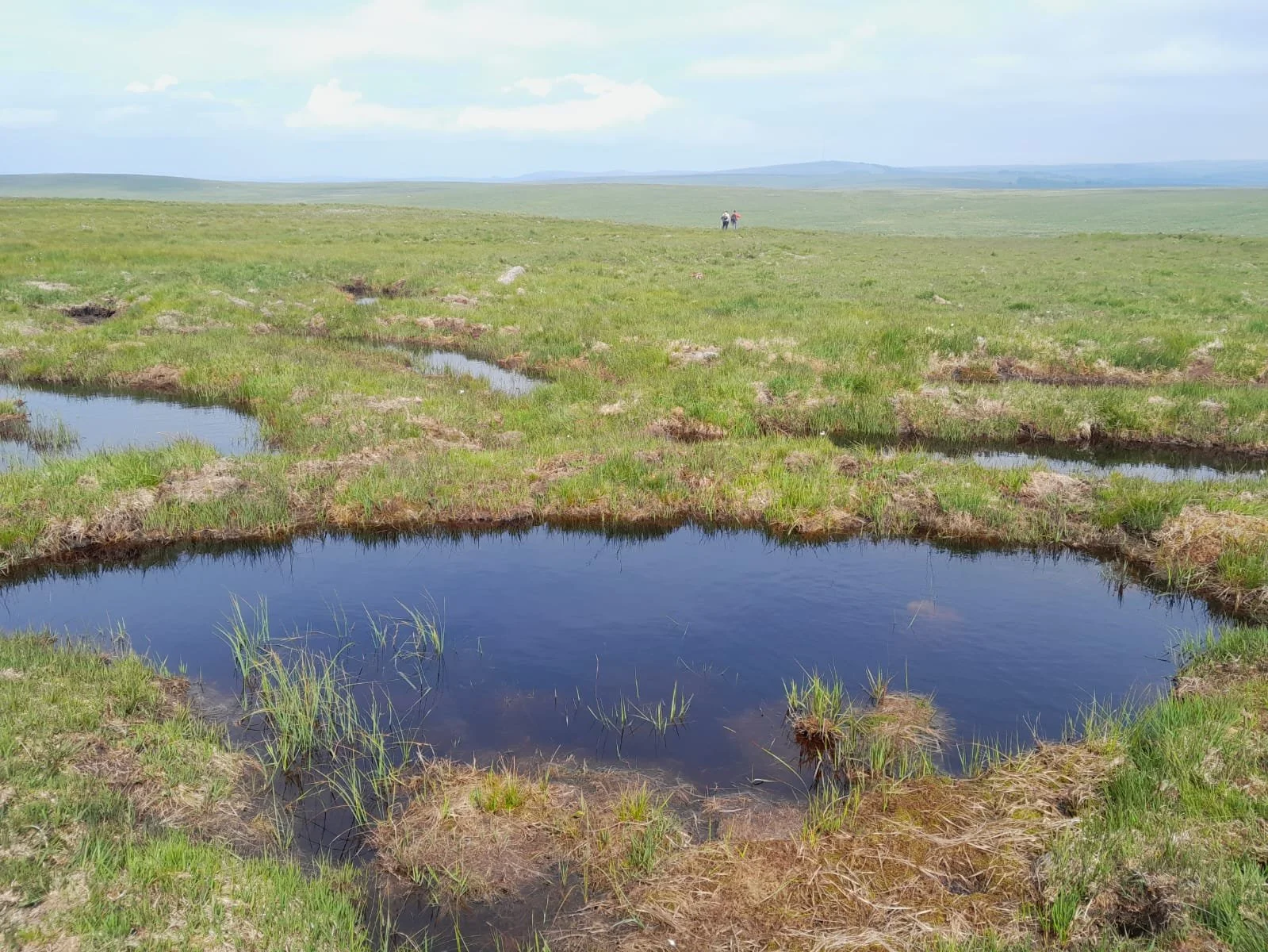
Image taken June 19 2024
While parts of the site retained relatively intact bog, much of the area’s peat is damaged due to the cumulative impacts of past human activity. Evidence of historic peat extraction can be observed across most of the site, with peat cutting as large as 50m wide and 200m long in places. As the head of the Plym, this is a key area chosen for works to help improve water quality downstream and slow the flow of water off the area. Whilst a challenging site due to remoteness, the range of techniques needed and the state of the degraded shallow peats, it was clear that without action, this incredibly huge store of carbon, palaeoecology and peat will continue to erode and wash away.
Before practical works began, the SWPP carried out a large body of work to compile a restoration plan appropriate for this site. These extensive documents contain details of site ecology, historic environment, landscape, access, land management, ditch blocking areas, timings and costs. All restoration plans are consulted and agreed upon by appropriate government bodies, landowners, farmers and commoners, following sector guidance and best practice for working on peatlands. Amongst others, key stakeholders involved include Natural England, National Trust, English Heritage Trust, Shaugh Prior Commoners’ Association, Dartmoor National Park Authority, Historic England, & Environment Agency.

Practical works began in January 2024 with local contractors using several wide tracked low-ground pressure machinery to carry out the works. This machinery enables our work to take place across this large area - 33 hectares - throughout the winter before bird nesting season begins.
The tilt rotator bucket seen here also enables the contractors to work in an agile manner and accurately target problem areas. This image shows the local contractors reprofiling and stabilising an exposed peat bank. The excess material to the right in the photograph, created through the reprofiling process, was utilised to create peat blocks nearby.
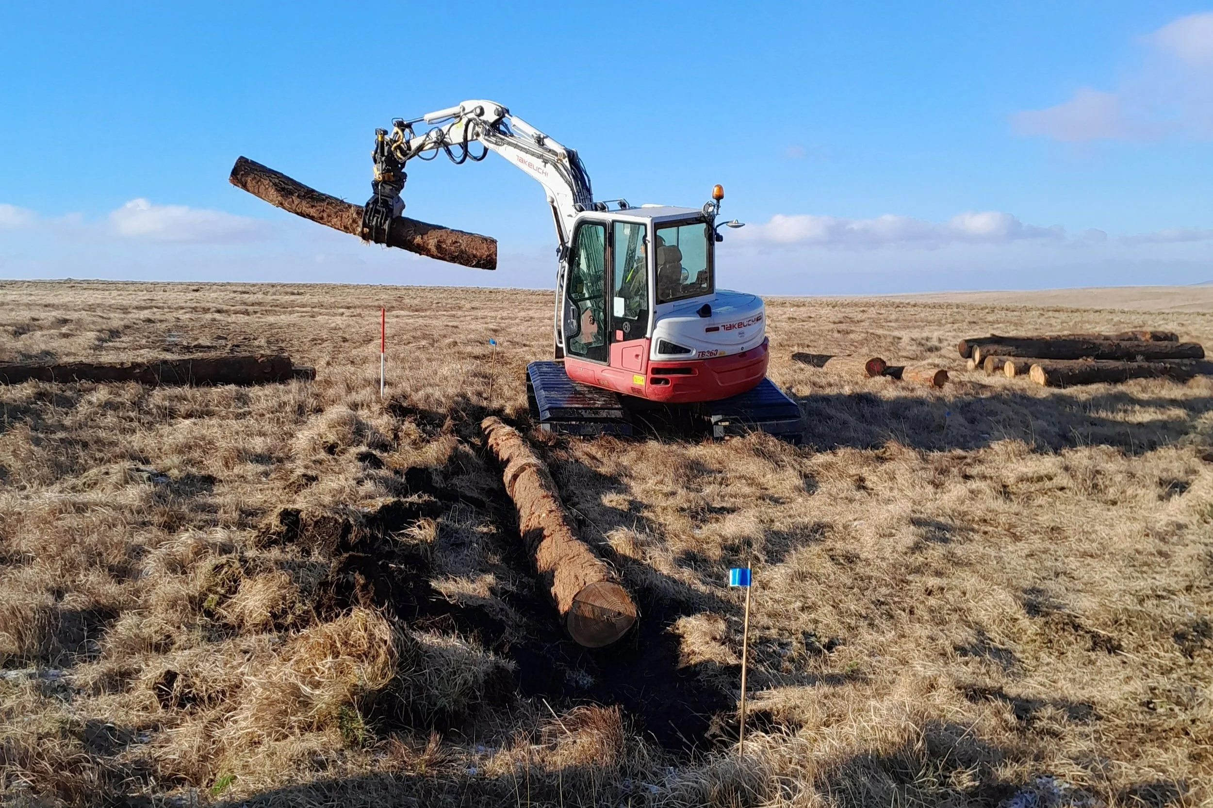
Wood can be seen here, produced by local conservation projects, being installed in areas where the peat is a poor condition to help slow the flow of water running through erosion gullies, manmade peat cuttings and peat pipes.


Pools of water with shallow gradient edges have since formed behind these wood barriers, over time encouraging a more diverse range of bog plant species such as Sphagnum mosses to colonise. Since the peat is no longer suitable to use as a blocking material on its own, the logs give strength to the blocks created within the peat cuttings.
Pools of water formed behind peat bunds on site. The aim is that in time, these pools of water help to raise and stabilise the water table in the surrounding peat, and fill with peat-forming sphagnum mosses, as well as acting for a brilliant habitat for birds, insects and helping to diversify the surrounding number of bog plant species. From past experience at other restoration sites, long periods without substantial rain may leave some pools behind dams empty for a time. As long as the water was there initially, and it comes back with the rain, then that desired change in the vegetation will occur in time.

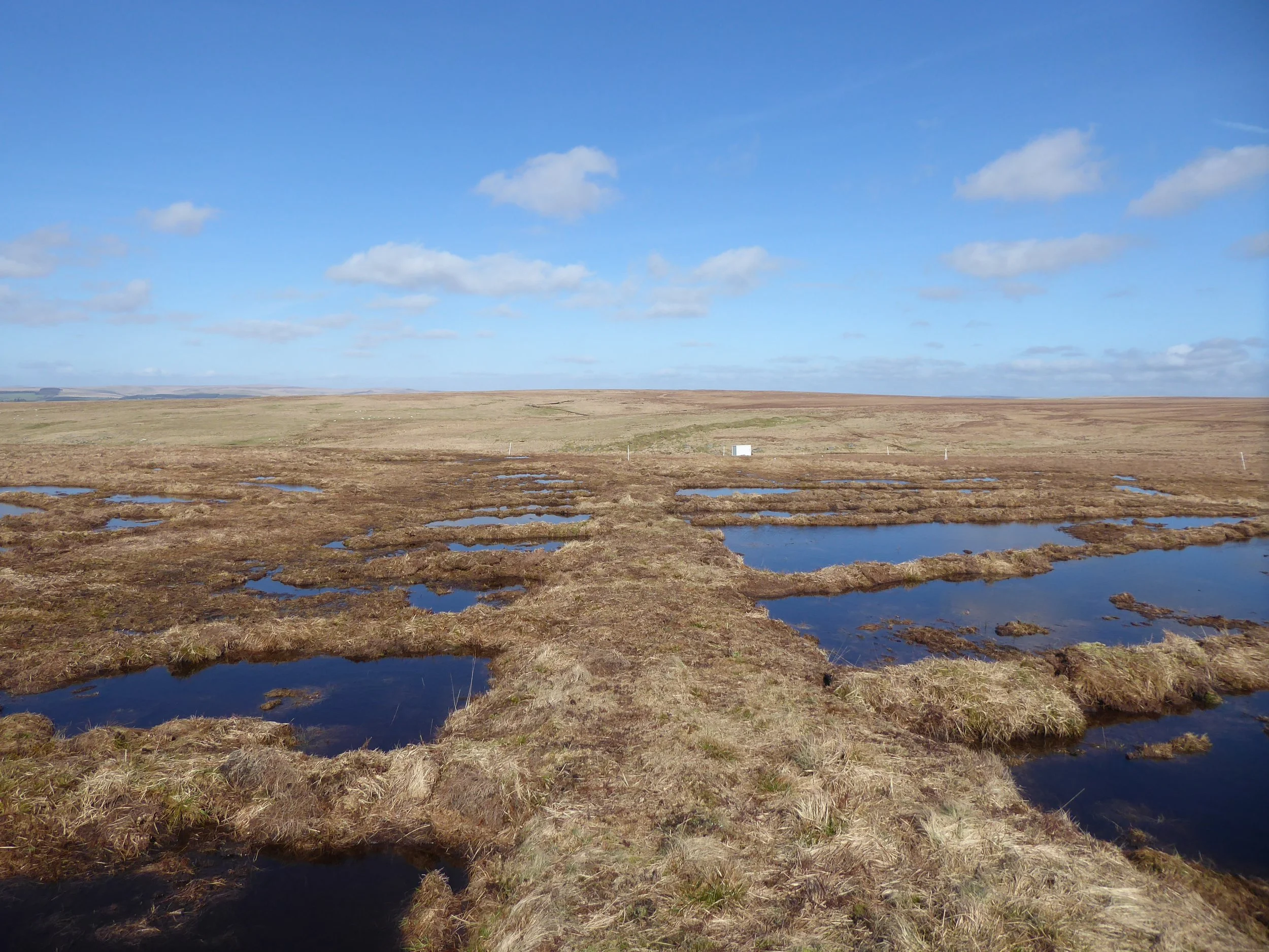
An area of peat bunding two months after restoration finished for the season. Re-vegetation of the area can be seen quickly taking place. These are now being monitored and SWPP will be carrying out repairs where any bunds show signs of erosion or damage through trampling.
An image of newly created peat bunds within some of the peat cuttings at Great Gnats’ Head. The design of the bunds helps to ensure that the feature of the peat cuttings can still be seen, showing the past use of the landscape, however reducing the draining and damaging effect on the peat’s hydrology that these cuttings have. Although these works have been hydrologically successful, they have been suspended going forward until a more detailed survey of the peat cuttings can be made as it is important record these historic landscapes before they decay or are altered by restoration works.
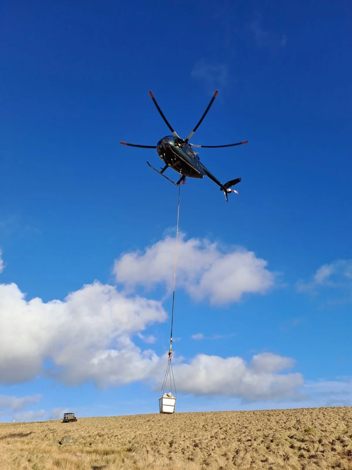
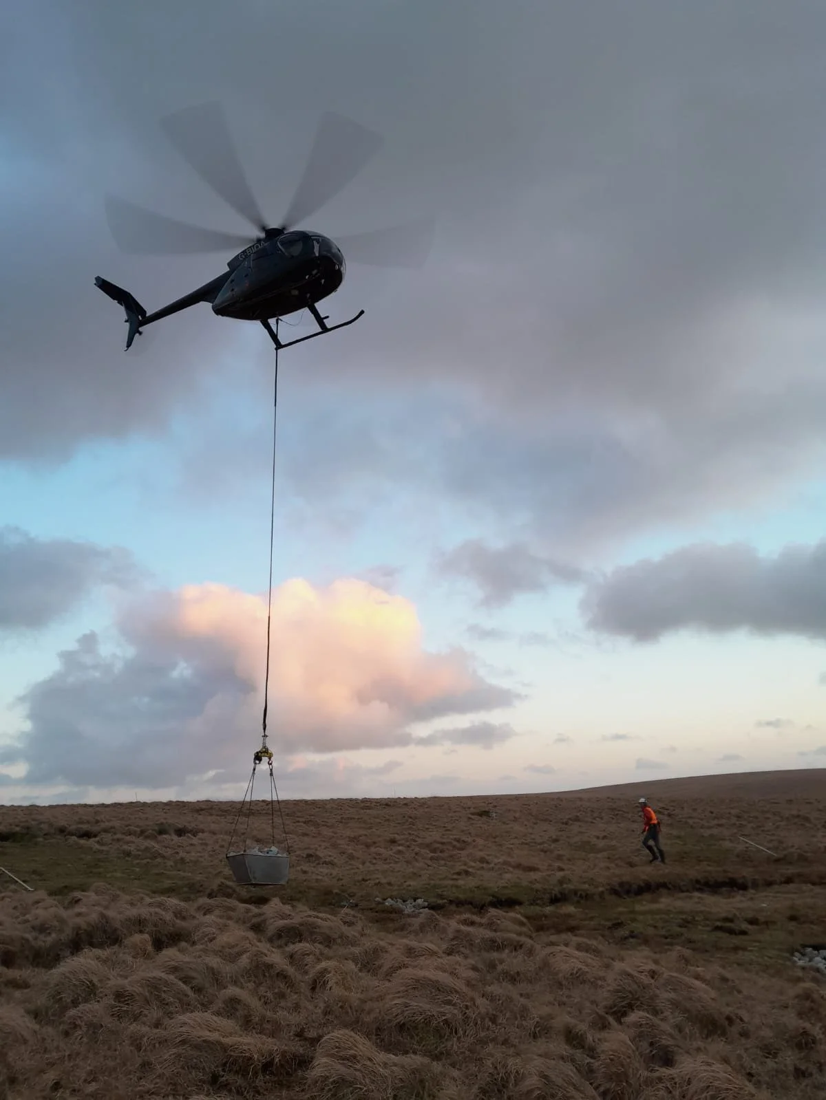
Whilst not a common feature of our approach here in the UK’s South West, some sites like Great Gnats Head are heavily degraded and very remote, meaning we have to think ambitiously and use techniques often employed by other partnerships working in peatland restoration elsewhere. A local helicopter company was used this season to transport around 170 tonnes of local granite stone from a quarry in Lee Moor up to the restoration site.
Flying in stone means minimal disturbance or impact on vegetation and habitats as the bucket of stone can be placed precisely in the spot where it will help to slow the flow of water down. This reduction of ground vehicle usage across the moor also helps protect the Upper Plym Valley area of important archaeological landscape, which includes sites from the Bronze Age and the Middle Ages like settlements and stone circles. We have been requested by local people and moor users to reduce vehicle movements across the moor and helicopter use helps us to meet that request. A short video at this link here explains the benefits of the use of a helicopter in lifting stone to peatland restoration site in the North Pennines.
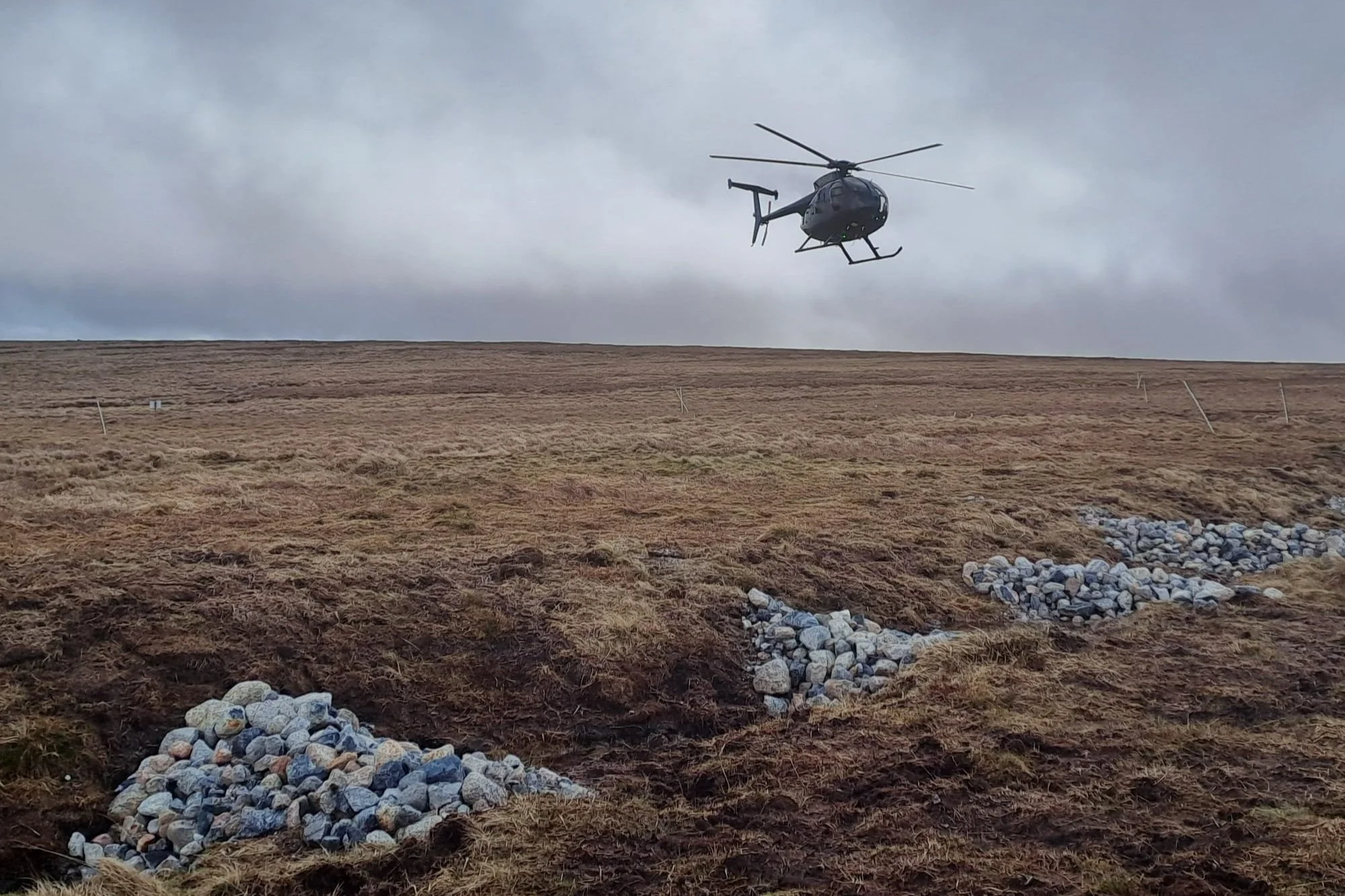
Due to historic peat extraction, the edge of the blanket bog consists of dry and poor-quality peat of little depth. Furthermore, the gullies around the edge have significant flows through them during high rainfall events. These factors mean that SWPP couldn’t just use peat or wood to block erosion features, instead we chose to use stone in these gullies. The immediate effect of the stone blocks is to slow the flow of water through them, preventing further erosion of the gully and subsequently, the blanket bog.
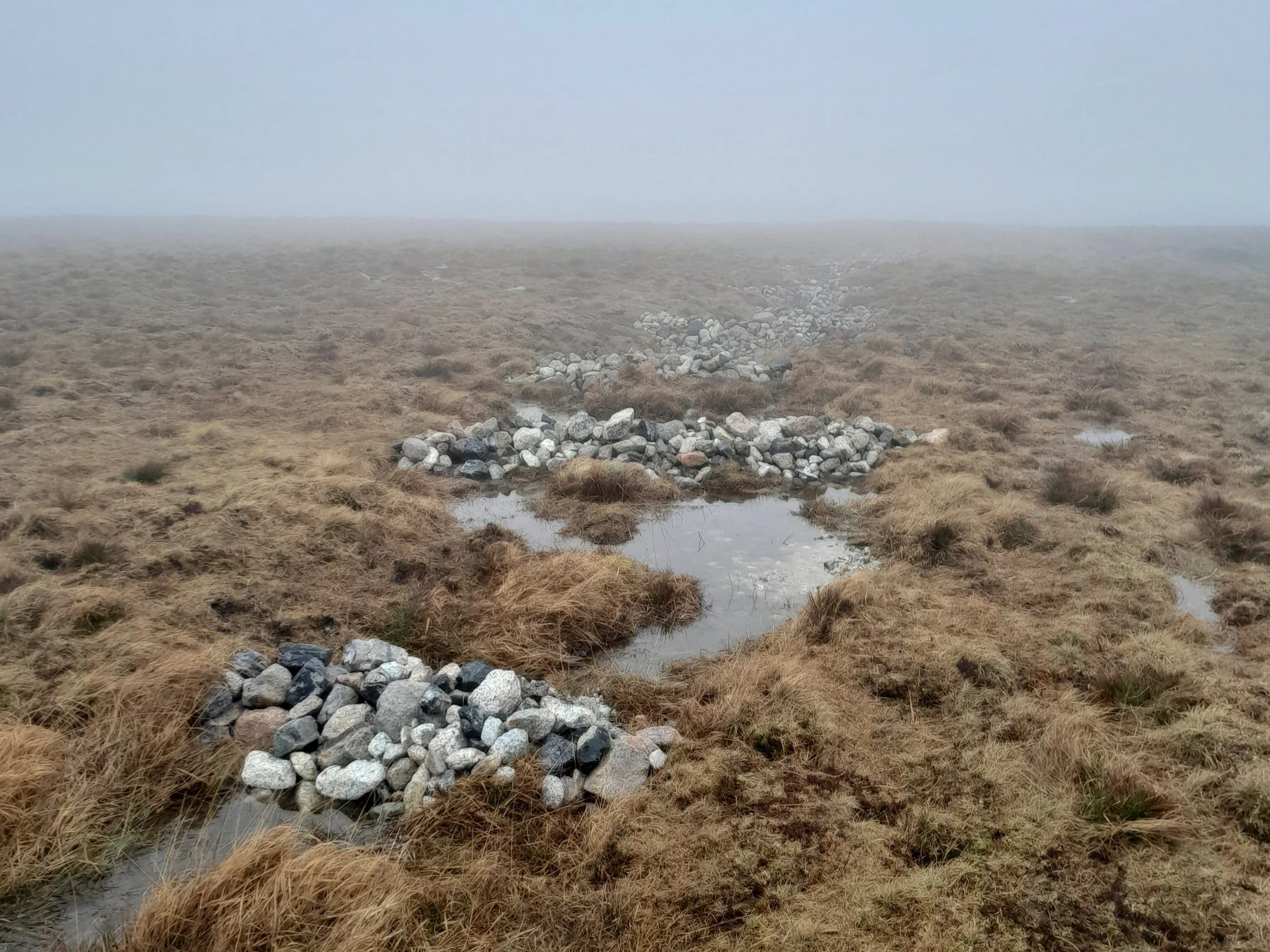
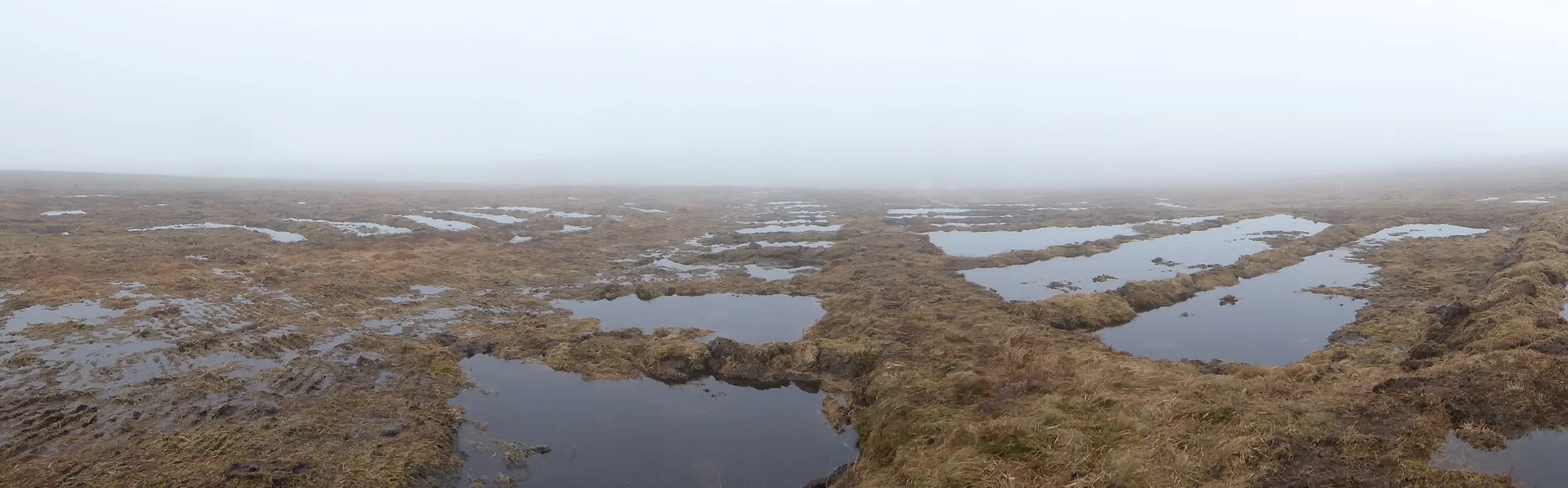
The flows through these blocks over time, combined with the encroaching vegetation, will see sediment build behind the blocks. This will increase the impermeability of the stone blocks, and see water pool behind them over time. As can be seen, after some rainfall, water is already pooling behind the stone blocks at Great Gnats’ Head. These shallow pools will already be helping to reduce erosion of the carbon-rich peat, creating more favourable conditions for wetland vegetation, such as sphagnum mosses to re-colonise these areas in the future.


The above before and after photos show an erosion gully within a peat cutting at Great Gnats’ Head with stone blocks installed roughly every 5m, with water pooling behind. This gully would have previously seen high flows of water during heavy rain. The stone will help to slow that flow of water down. Over the summer and any dry spells we see, these pools may well draw down due to the shallow nature of the peat and severe erosion. We will monitor the water levels and make adjustments as needed.
Whilst freshly washed and bright currently, the stone will in time likely cover with vegetation, blending into the landscape and playing a crucial role in trapping sediment, as has been seen on other restoration sites SWPP has worked on.

The long-distance walking route the Abbot’s Way hugs the edge of the restoration site, which meant several hikers passing by as we worked. Kept informed by signage of why they were seeing our low-ground pressure machinery out so remotely, it was great to chat to members of the public about our work who stopped to chat.
One thing that hikers often ask us about is whether the pools of water created are a risk to livestock on the moors. It’s a valid query, as craters and other steep-sided pools found on the moor may cause a risk to an adventurous sheep, however we have never been made aware of any livestock stuck in an area of our restoration. That’s because we strive to ensure a shallow gradient to the pool sides and provide walkways between bunds for people and livestock.
Where peat is taken to be used elsewhere in the creation of bunding, we create ‘borrow pits’ – small areas where the peat is taken and a pool forms in its place. We are continuing to learn the best ways of doing these for people and our peatland restoration works. Some moor users prefer larger pits so they can be seen more easily, and others for them to be smaller so they can be driven around more easily. Looking back at the borrow pits created at Great Gnats Head now works are paused, we feel that they are more steep sided and larger than we would like to create. We intend to return to these to rectify this and create a more shallow gradient on the pits created this season.

The Upper Plym Valley has been under the Guardianship of the Secretary of State since 1979, and has an extensive amount of archaeological and historic features in the area. The cairn on Great Gnat’s Head can be seen in the above image. It’s a pile of rocks, a walkers’ cairn that was much smaller in photographs from the 1950s. It sits on top of a stony mound about 12m in diameter that is a scheduled monument as it is thought to be a bronze age cairn. It was excluded from all SWPP restoration works and a perimeter was marked around it to be avoided by vehicle movements.
Before practical works began here, the site had an extensive planning and consultation process regarding the heritage assets and archaeological features in and around the area. The historic features of the GGH site were examined by the SWPP Historic Environment Officer (HEO) through methods such as examining historic maps, photography, aerial and LiDAR survey, and carrying out multiple walkover surveys of the site. The Historic England survey on Dartmoor and Upper Plym Valley was also reviewed and informed planning. Mitigation methods were included in planned works, including the use of wide-tracked vehicles, briefings for contractors by the HEO and work and access exclusion zones established to protect features such as cairns and boundary stones, and excluding all tin-streaming areas from restoration works.

In the past, areas of Dartmoor were cut for peat, whether by prisoners to produce naptha – an oil – at Dartmoor Prison, or by people using the peat for a fuel or growing medium. We can see many remnants of this at Great Gnats Head such as in the image above showing a peat cutting. The left-hand figure stands within the peat cutting and the right-hand is up on the unexcavated baulk. The edge of the cutting runs down toward the camera on the right. You can see that the edge is now a sloping, vegetated feature; originally it would have been a vertical face of bare peat. Slow decay is making these cuttings less distinctive over time.
The walkover and desk-based survey identified an extensive area of turf cuttings and peat-charcoal burning platforms (known as meilers), that had not previously been fully recorded on the Historic Environment Record and will now be added. The above image shows a meiler or peat charcoal mound on the southern edge of the restoration site. There are many of these to be found across the site and were excluded from the restoration works. This one has been suffering from erosion where livestock have been rubbing and sheltering against it. The exposed faces were cleaned, recorded and samples taken by specialist contractors. Turf and logs were then used to protect the feature.


The above images show another meiler on the site. In this case the feature has been eroded by the passage of water running down the edge of a peat cutting. Archaeologists cleaned up the edge of this meiler for recording and sampling. We await the results of specialist reports on this work.

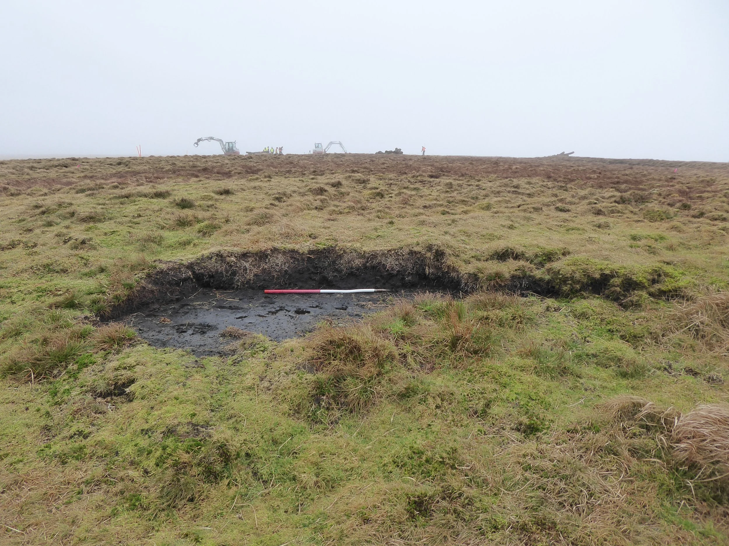
Monitoring of the site pre, during, and post-restoration includes monitoring of vegetation, hydrology, peat depth, fixed-point photography and wildlife surveys. A line of dipwells that measure the water table can be seen across this eroding gully, installed to assess the impact of the restoration works.
Practical works for the winter of 24/25 to tackle further degrading areas of peat at Great Gnats Head are currently in the planning, consultation, and research process. We look forward to returning to this site to find the best ways to increase wildlife and plant diversity, reduce sediment runoff, raise and stabilise the water table, whilst preserving the rich historical and cultural landscape of the area.