Tavy Head photo update
We’re starting 2025 as we mean to go on, with our award-winning peatland restoration taking place across Dartmoor & Exmoor through the winter and into spring.
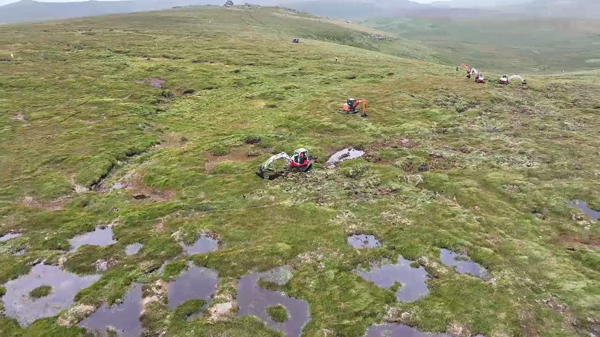
Works continue at Tavy Head on Dartmoor, the South West Peatland Partnership’s largest and most remote site to date. The scale of the works taking place is vast, with up to 9 low-ground pressure diggers on site at any time, blocking erosion gulleys, reprofiling bare peat hags and improving the hydrological functioning of the globally important and carbon-rich blanket bog.
Now, 5 months into the latest peatland restoration season, and with the full strength of Dartmoor’s winter weather fully set in, let’s look back at the why, how and what next for this remote, ambitious, complex and fascinating area of Dartmoor.
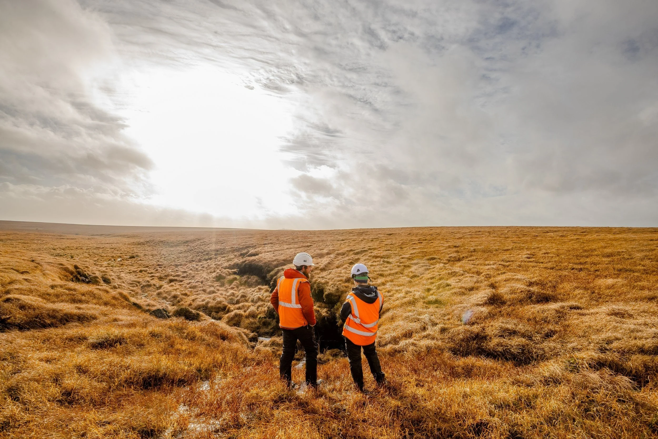
Two of the SWPP team assessing a large erosion gulley at Tavy Head. Credit: Jakob Pegler
Before practical works began, the SWPP carried out a large body of work to compile a restoration plan appropriate for this site which sits in the Forest of Dartmoor on Duchy of Cornwall land. These extensive documents contain details of site ecology, historic environment, landscape, access, land management, ditch blocking areas, timings and costs. All restoration plans are consulted and agreed upon by appropriate government bodies, landowners, farmers and commoners, following sector guidance and best practice for working on peatlands. Amongst others, key stakeholders involved include Natural England, Duchy of Cornwall. Forest of Dartmoor Commoners’ Association, Dartmoor National Park Authority, Historic England, & Environment Agency. Works are being carried out at Tavy Head by Castleford Engineering, and Quantock & Exmoor Ltd.
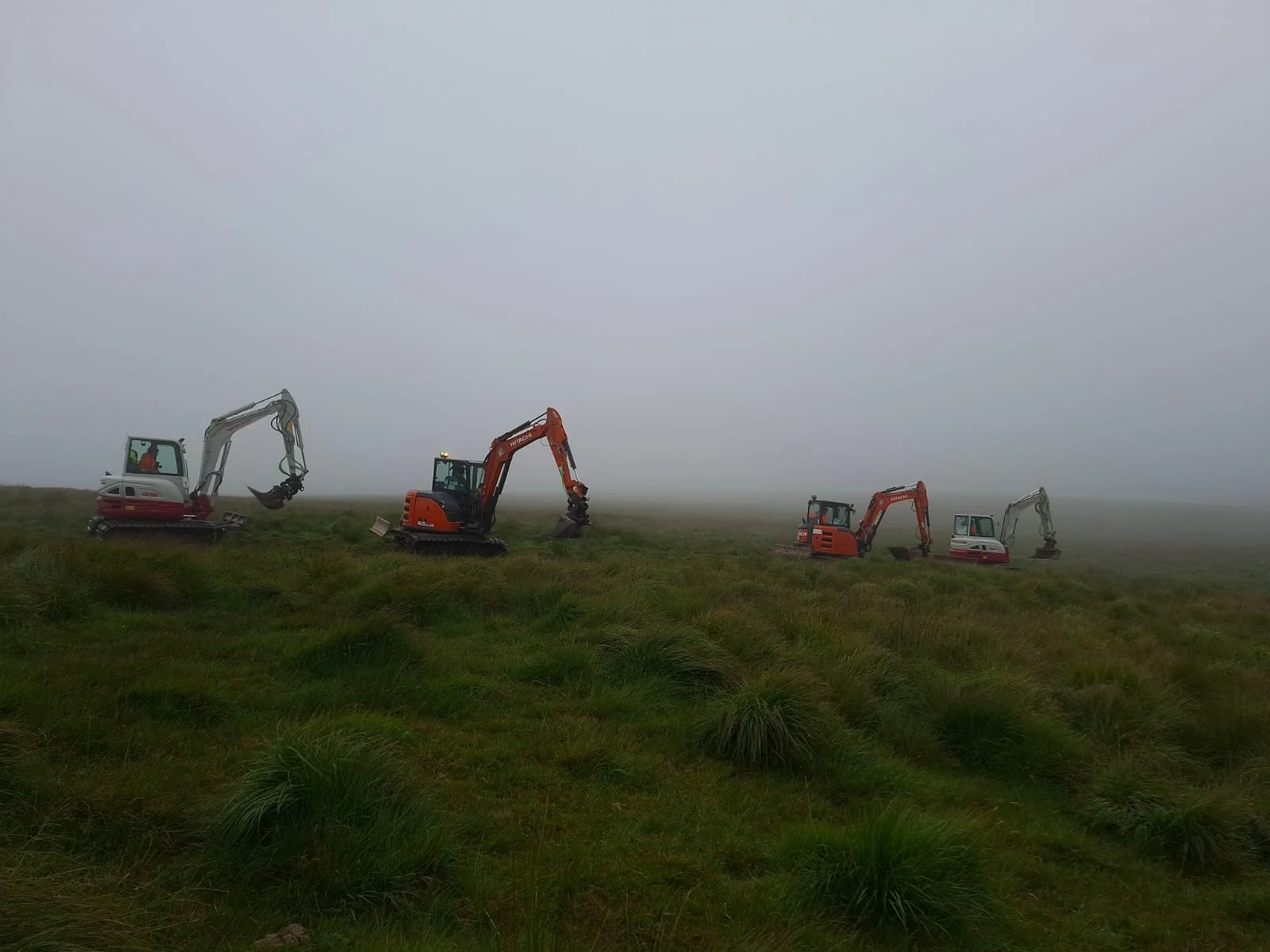
Machinery heading out to Tavy Head for the restoration season, August 2024
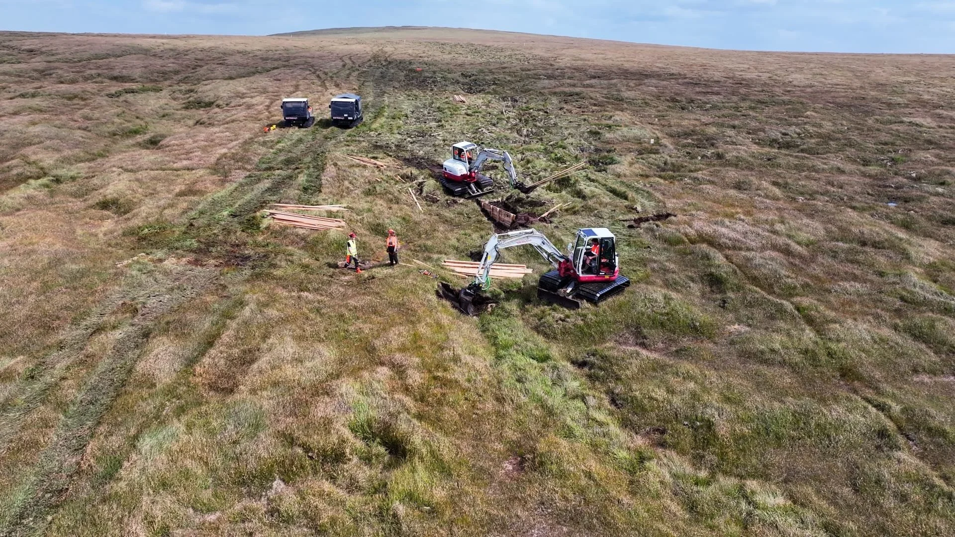
Practical works began on a foggy day in August 2024 with contractors using several wide tracked low-ground pressure diggers to carry out the works, and 3 low-ground-pressure all-terrain vehicles (ATVs) to travel out to site each day. This machinery enables our work to take place across this large area effectively before bird nesting season begins.
All restoration vehicles and machinery will be tracked and have low ground pressure (<3psi), exerting less pressure per square inch than a human does on the ground. These excavators are what enables us to do what we need to do. They enable us to work effectively at scale. providing the capability to move and shape the peat and turfs of vegetation to restore the peatland, often in areas that are very wet and hard to work in on foot. Alongside the specialist tracks, these machines are fitted with tilt-rotating buckets that provide our skilled digger drivers with more dexterity than they would have with their hands - this reduces the need for lots of small movements and minimises ground disturbance.
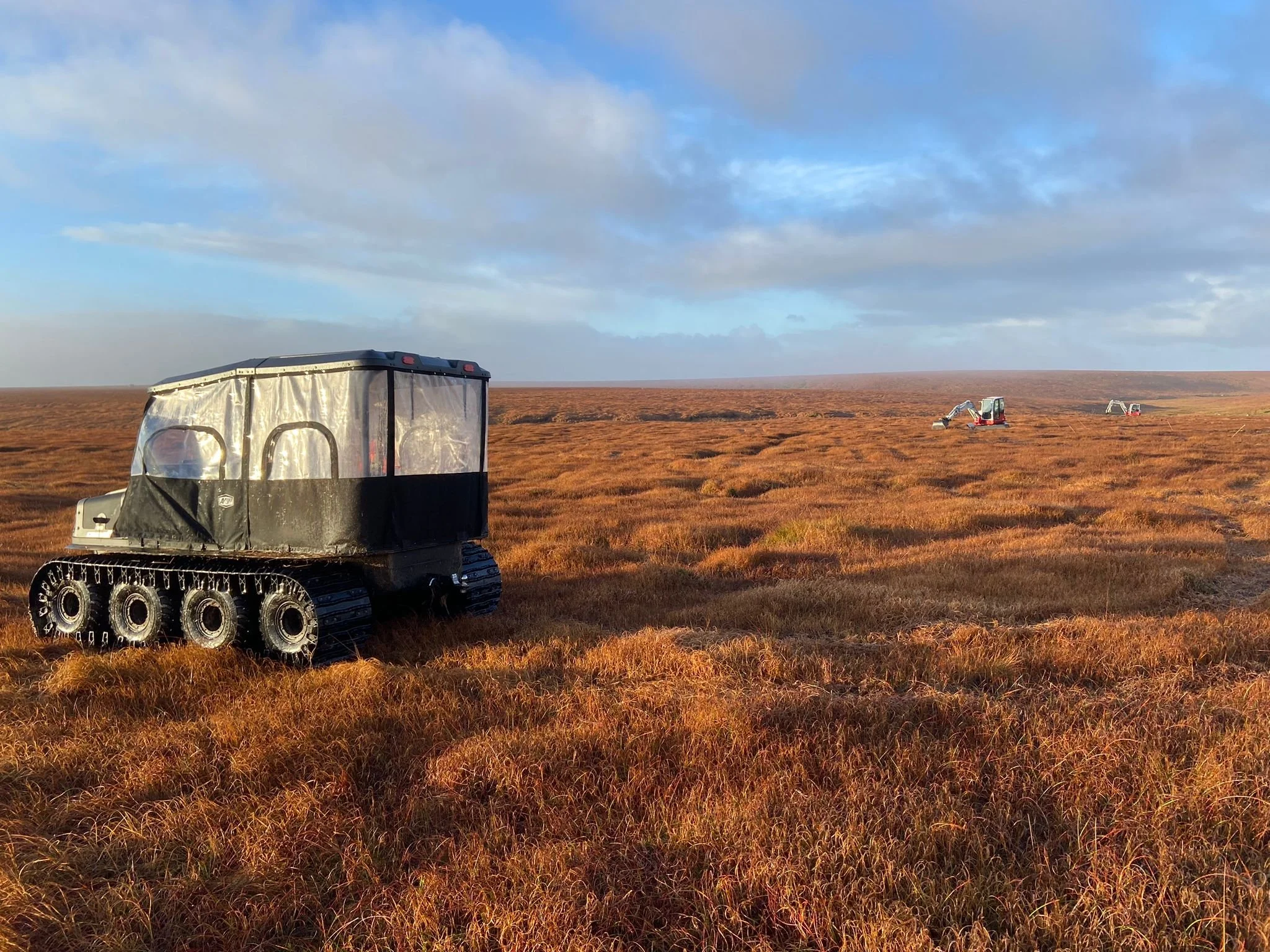
Image shows an ArgoCat, a low ground-pressure people transporter used to travel up to 45 minutes across the moor out to Tavy Head
For our contractors working on the site access is hard and takes a long time, and during frequent periods of thick fog navigation can be difficult. We have been working on the site since November last 2023 so we need to be careful to limit our impact ground conditions. When travelling in ATVs we spread out across varied routes. This serves two purposes:
1. To limit our impact on the ground and ground disturbance.
2. To flatten a large area of grass which will act as a fire break and allows easier passage for commoners in the event of a fire.
We cannot always spread out across a large an area as we may like due to archaeological exclusions or the terrain (steep slopes, streams and large gullies) which means that there are some pinch points where we have to travel on the same route often.
SWPP are working with the Forest of Dartmoor Commoners to install two clapper bridges to provide access across streams. This stone will be sourced locally by the commoners and put in place by SWPP contractors. We are also working with the FoDC to help maintain thei access across some of the particularly wet areas of the site by creating a grid system of larger dams that will be accessible by quadbike, enabling better movement across the moor when gathering stock.

Low-ground pressure diggers out in the fog at Tavy Head, March 2024
The peat surrounding Tavy Head is an important, but challenging site to work at. Remote and approximately 240 hectares in size, this site has 5 streams leading from it feeding into 3 rivers. This makes it a key area chosen for works to help improve water quality downstream and slow the flow of water off the area. With over 6 metres of peat in some places sitting directly behind an eroding hag, the peat will continue to erode and any carbon stored within will be lost to the atmosphere and any paleoarchaeology will be exposed and damaged, should action not be taken.
SWPP starts by aiming to achieve full hydrological restoration of the peatland by blocking gullies to raise the water table within the peat to a point where the surface of the peat is wet, meaning that any plants that die slowly get turned into peat.
If this is not achievable then efforts will be made to block channels to raise the water table as far as possible and to take any erosive flow out of the peat, this is often done using leaky dams.
Any bare peat hags that are found on site are reprofiled (made into a gentle slope) and are covered in turf this is to protect against wind and rain erosion. These works should create the conditions needed for peat-forming sphagnum mosses to colonise and spread.

The past few months have seen works continue in this area, following on from restoration over the winter of 23/24. The above image shows shallow pools of water created by restoration interventions last season, bedding in to the landscape with peat-forming sphagnum mosses beginning to colonise.
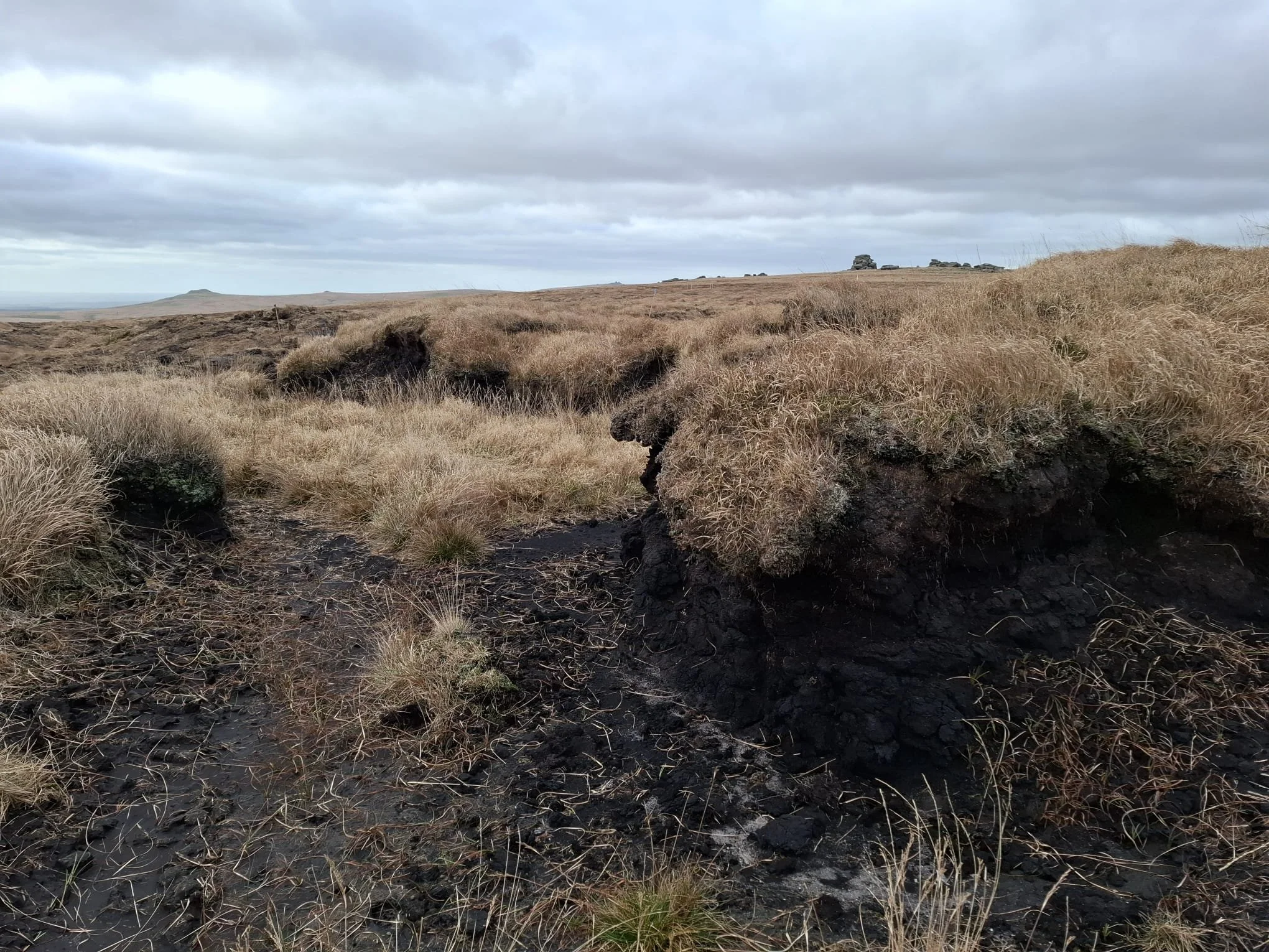
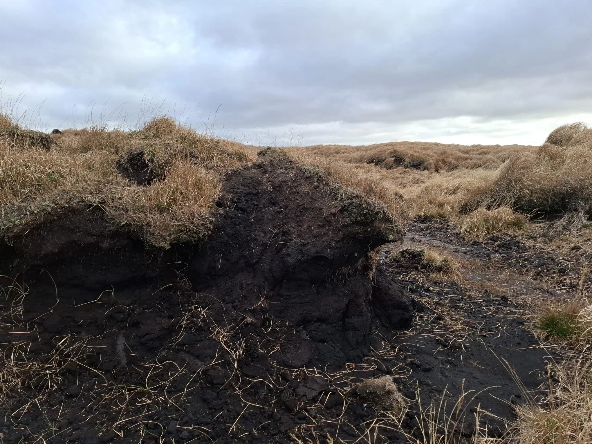
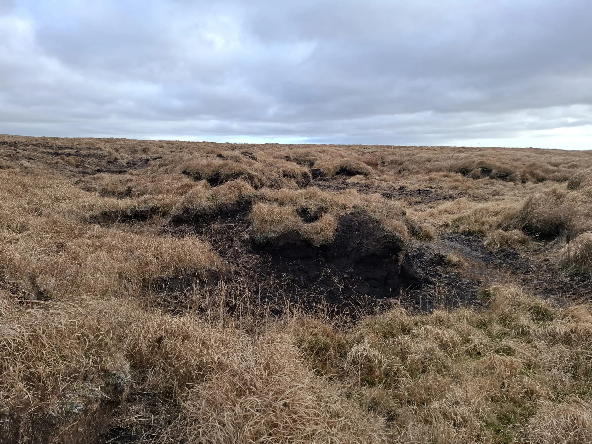

Areas of peat degradation, erosion channels and bare peat on the Tavy Head site, prior to restoration interventions
While parts of the site retain peat-forming plant communities on a relatively intact and healthy bog surface, much of the area is damaged due to cumulative impacts of tin streaming, burning, military activity and overgrazing. This has led to complex actively eroding gulley systems, extensive areas of dendritic erosion, ‘peat pipes’ below the surface, and ‘cliff-edges’ of peat at the head of the tin-streamed valleys. The impacts of the low and unstable water table in the peat can be seen by the dominance of purple moor-grass (Molinia caerulea), with little Sphagnum or other diverse bog species.
Without action, the bare peat seen will continue to erode, losing the large carbon and palaeoecological record stored within.
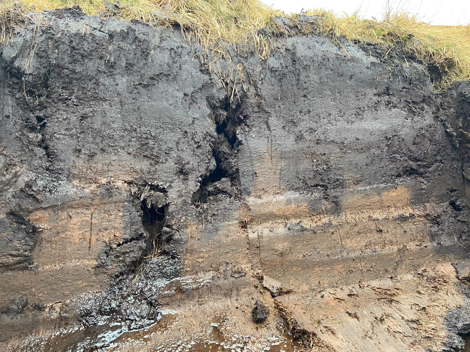
A cross section of peat showing why our work is important. If a healthy area of bog, we would expect to see thick yellow brown layers (waterlogged, little decayed peat) at the surface gradually transitioning to highly compressed ancient black peat deeper down. Instead, we can see a black 30cm layer at the surface indicating that the bog surface is no longer hydrologically active and has oxidised (rotted) and therefore released it's CO2. The ‘peat pipe’ – channel that has formed below the peat - has let air in, rotting the waterlogged peat around it and creating the black ring around the pipe.
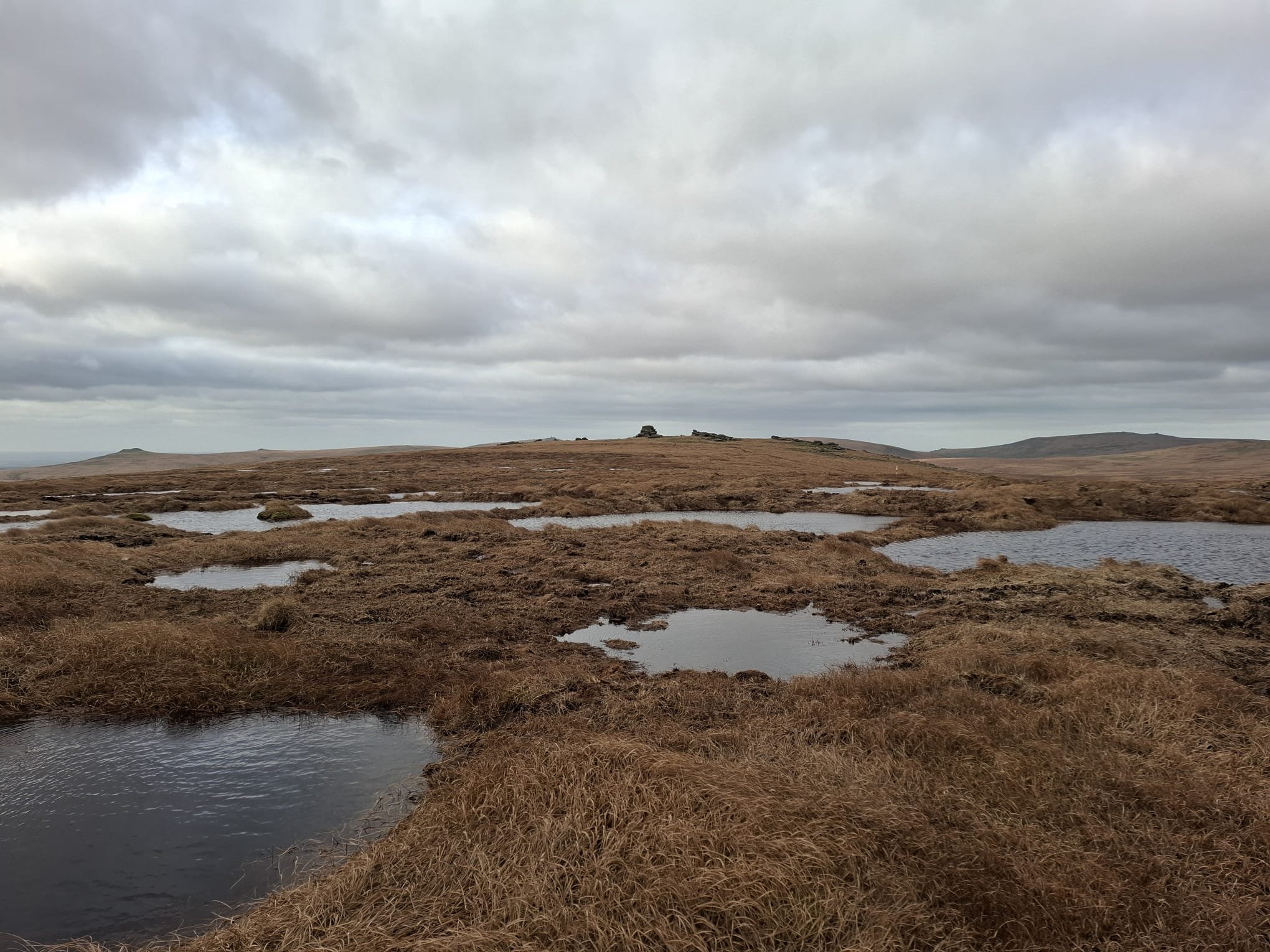
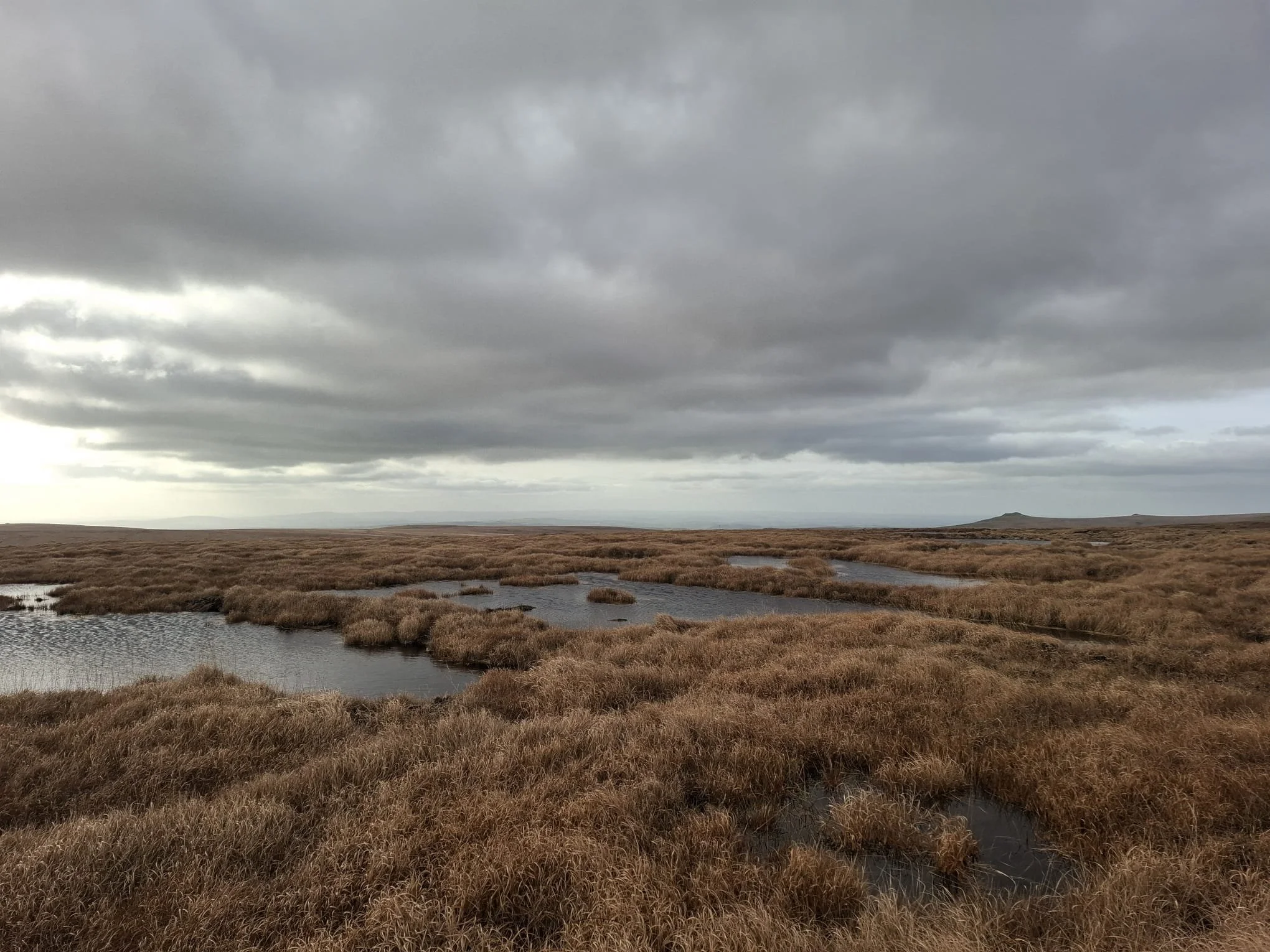
Image shows bunds made using peat taken from ‘borrow pits’, and the water pooling behind them, with Fur Tor in the background
These blocks are built using good (wet, putty) peat sourced away from the erosion gulley or ditch to be blocked by contractors. This is then capped with vegetation to stop erosion. Often, low arc shaped features that are approximately 5m wide, peat bunds can be linked together in a fish scale effect to rewet wider features and slow the flow of water across the area. Now, instead of bare peat and dry gullies causing large amounts of water to run off, the area is holding water back in the landscape, with birdlife like teal spotted using the pools, and will in time fill with peat-forming sphagnum mosses.
This is hydrological restoration of dried and degrading blanket bog on a really impressive scale. Water aims to end up in rivers and reservoirs more gradually, rather than the flashy runoff seen in periods of heavy rainfall. Over time, these pools will begin to fill with peat-forming sphagnum mosses, diversify the surrounding plant species and create the conditions needed for carbon-rich peat to form once more.
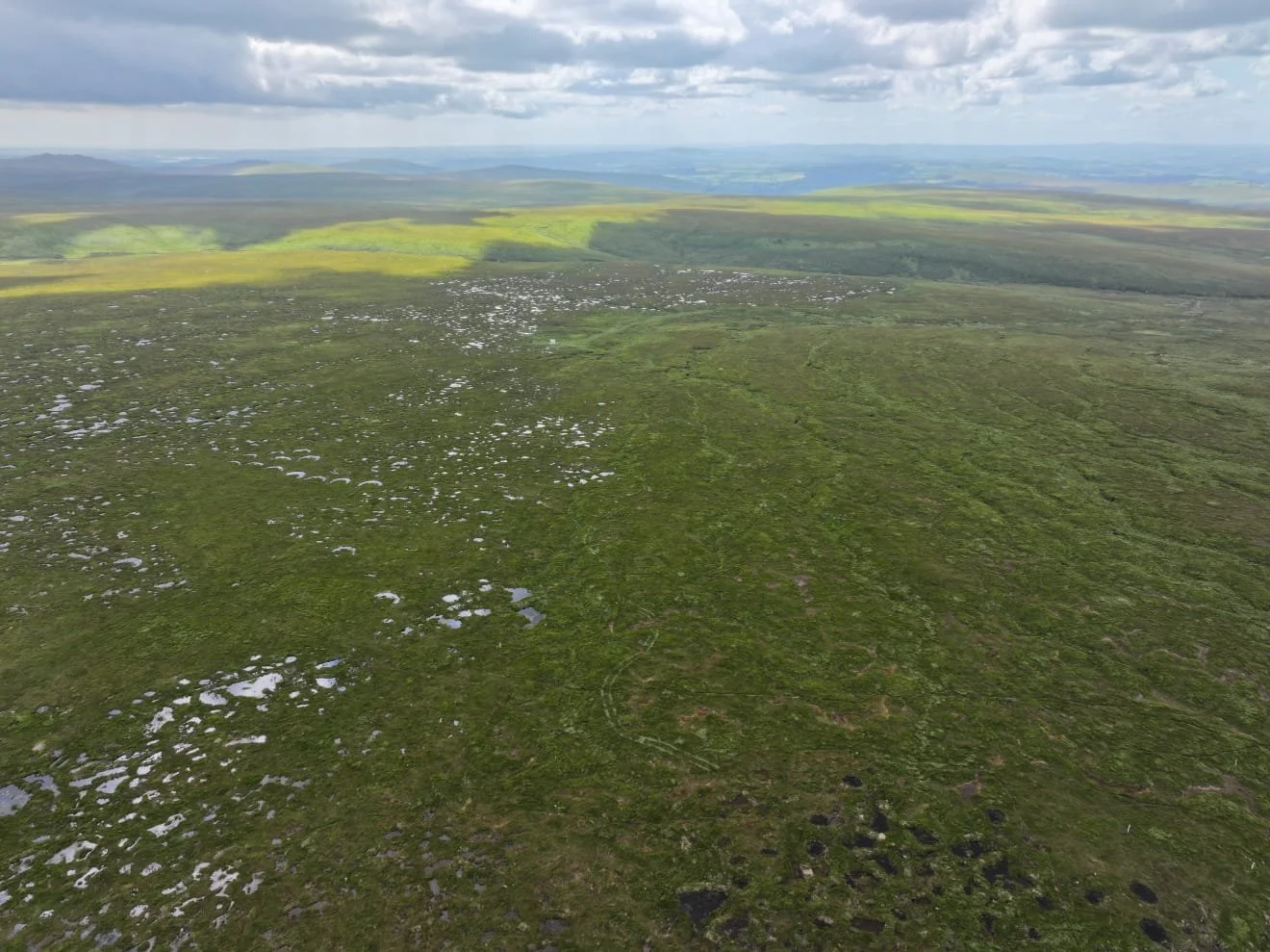
The scale of the works can be seen in these aerial images, of the area where works have taken place (left) and unrestored areas (right) taken in August 2024 Credit: Quantock & Exmoor Ltd

This image, taken from eye level, shows routes for crossing the area of restoration via the wide peat bunds, providing access for hikers and livestock alike. November 2024
One thing that hikers often ask us about is whether the pools of water created are a risk to livestock or people on the moors. It’s a valid query, and care must be taken when traversing the moor, particularly as craters and other steep-sided pools found elsewhere on the moor may cause a risk to an adventurous sheep, however the team took care to meet and discuss with the local leer holder and commoners who have livestock in the area to discuss any potential impact to grazing, of which none were raised. We also strive to ensure our approaches provide walkways between bunds for people and livestock, and a shallow gradient to the pool sides as this also helps with reducing wind erosion and allowing sphagnum moss build up.
In some areas at Tavy Head, the scale of erosion and potential for positive impact as a result of our work has meant that larger pools have been created. These larger pools have shallow sides to them and peat in the middle to ensure they are not too deep. These can be seen from near to Cut Hill and Fur Tor, and already the team are spotting teal and other wetland birds on and around the water. Overtime, these pools should also fill with sphagnum mosses, diversify the plant life in the surrounding area and reduce the erosion of the peat seen on the edge of the hill.

Wooden blocks, covered in peat and vegetation, doing a brilliant job spreading water out from an erosion gully and across a slope. In time, these should fill with sphagnum mosses, as seen elsewhere on Dartmoor peatland restoration sites. January 2025


An area of previous peatland restoration works, nearby to Tavy Head, holding back water and filling with a huge amount of sphagnum mosses, and diversifying surrounding plant life. This is what areas of Tavy Head could look like as a result of our work in just a few years. August 2024

Image of SWPP Historic Environment Officer conducting a walkover survey out to a restoration site Credit: Jakob Pegler
The historic environment assets of the Tavy Head site were examined by one of the in-house SWPP Historic Environment Officers (HEO) using desk-based assessments, examining the Historic Environment Record, historic maps, aerial photography and LIDAR survey. Various reports and surveys looking at MoD usage of the area were examined, and walkover surveys carried out. The walkover particularly targeted eroded areas where prehistoric features, buried within the peat might be revealed. No finds were made. These assessments included routes to the site to be taken by the contractors.
The HEO put in mitigation rules to reduce any potential negative impact of the works on the historic environment. These included briefing onsite contractors, making monitoring visits and establishing exclusion zones for machinery to protect heritage assets – displayed using flags on the ground, and marked on both digital and paper maps.
The bucket of the excavator cuts through the peat so efficiently, that any change in the texture can be instantly detected by the experienced contractors driving them. They are also able to spot any artefacts on or in the peat and call the SWPP HEO to take a look. Last season, Unexploded Ordnance surveyors who scan Dartmoor sites to reduce the risk of encountering ordnance buried in the peat, and who had also been briefed on the possibility of archaeological finds during works, noticed an unusual sight: a straight edged block of granite at the bed of the channel.
SWPP HEO Martin headed out to the site to take a look at the find before works could resume blocking. Despite the unusually straight edge to the stone, no evidence of tool marks could be seen. Also, being so far in the middle of Dartmoor, and so far down in the peat that it would have been thousands of years old, we can say that in this case it was just an unusual geological feature, unearthed by the erosion of peat by water.
Read more of the find on our Instagram here: South West Peatland Partnership (@swpeatland) • Instagram photos and videos
Contractors also identified an artefact from near the surface on the site and brought it to the HEO’s attention. It appears to be a whetstone for sharpening tools; it will be sent off for expert examination and added to the National Park Historic Environment Record.
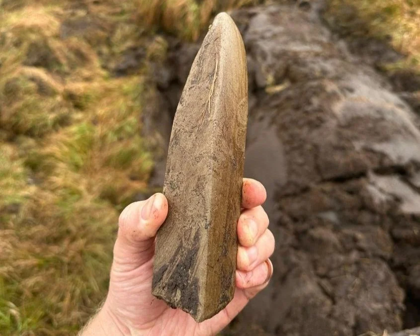
The whetstone found at Tavy Head
SWPP has been working in partnership with the Ministry of Defence and the Training Safety Officers at the Dartmoor Training Area. This has meant that we are able to work during the live firing and fit in accessing the site around the MOD Live firing schedule for the Merrivale Range, this can be found here.
Historic use of Dartmoor in military training means that there is a risk of excavators finding unexploded ordnance (UXO) buried or partially buried within the peat as it is moved around. For this reason, UXO contractors are onsite the whole season, sweeping ahead of machinery with metal detectors to ensure site safety. If potential UXO is found it is marked with a flag, and workers avoid the area. If live ammunition is detected of a large size, is found, expert UXO contractors work with the MOD and the bomb squad to make sure it is safe. UXO detection can cost a large part of the site budget for restoration works each season, but is a crucial part of working safely and reducing risk to workers out on the moors.

Image shows a dipwell, installed and used to determine water table depth pre-restoration and track any changes in water levels after works. Data is collected every 15 minutes automatically, helping to build up the picture of how the interventions are helping to hold water In the landscape. Credit: Jakob Pegler
A combination of monitoring took place before restoration interventions began and continue under the watch of SWPP’s monitoring team and through collaborations with universities, researchers, commoners and surveying contractors. Baseline data will be collected pre-restoration and monitoring will continue post-restoration to observe any changes on the site.
A gully that has had restoration interventions and a control gully have been set up for comparison in which we will monitor vegetation, hydrology, peat depth, Fixed Point Photography (FPP) and Eyes on the Bog (metal rods in the peat that monitor water table behaviour, peat accumulation and carbon flux). SWPP also be monitoring for breeding birds, stock movement changes using tracking collars and any access routes changes for moor users.
One of the contractors that we work with, Quantock and Exmoor Ltd, carrying out peatland restoration interventions at Tavy Head. Credit: Quantock and Exmoor Ltd
“Tavy Head presented an exciting and challenging project; a vast and isolated site with huge restoration potential. Utilising low-ground pressure machinery; our team worked closely with SWPP to employ a myriad of techniques to work towards acheiving hydrological restoration with all consideration to the historic Dartmoor environment.
Dartmoor is a beautiful place to work; whether visibility is 100s of miles on a clear day or 5 metres in the thick fog. However exposure to the elements creates unique challenges. Through two winters of freezing conditions and record rainfall, the commitment and dedication of SWPP officers and our team have been vital to delivering this landmark restoration project.” - Quantock and Exmoor Ltd
We’ll bring you updates on this impressive and ambitious site over the next few months, and as works bed in going into the summer. Thanks to everyone who has worked together to enable this vital work to happen – landowners, commoners, contractors, funders alike – we couldn’t do it without you.